


")


Graphical information System and Environmental Management.
-
OWN CAD EDITORfor creation and maintenance of maps for green spaces
-
PROCESSINGof geodetic plots of green space into maps
-
CENTRAL ADMINISTRATIONof maps and drawings documentation online
-
COMPATIBILITYwith all world map formats (AutoCAD, Microstation, ESRI, Kokeš,...)
BRANCHES VERSIONS FOR:
 Tree and open spaces (Arboreta)
link to urban structure and historical significance
 Parks: city and town green spaces
 vegetation is one of the most important aspects of urban residential development

INVENTORY AND CLASSIFICATION OF VEGETATIVE ELEMENTS
THE AIM OF INVENTORY IS OBTAINING DATA FOR ADDRESSING THESE QUESTIONS
 content, operation and composition of the object green space or its part alongside roads and in residential placesconservation, regeneration, reconstruction or rebuild
INVENTORY RESULTS
topography and identification of VPcharacteristics, function and potential of VPcalculation of ecological value, recalculationbasic value of stability by the method SIA
the suggestion for provisions, assigning catalogue number URScalculation of financial costs (URS) for realisation of suggested provisionscontrol and valorisation of realised provisionsCAD / GIS
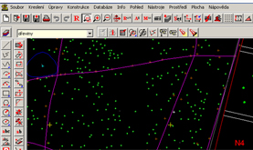 own CAD/GIS Engineown CAD editor for creation and maintenance of maps for green spaceprocessing of geodetic location measurements of green space into mapscentral management of maps-drawings documentation onlinecompatibility with all world map formats (AutoCAD, Microstation, ESRI, Kokeš, ...)
PASPORT GREEN SPACE
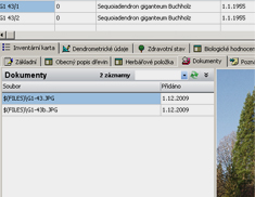
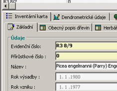
Inventory card of green space
Ecological value
Plant out
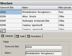
Propagation
MAINTENANCE AND FINANCIAL PLANS
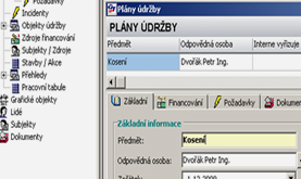 plans for green space maintenance in connection with pasport - types of green spaceconnection to determined cluster of green spacederivate financial planscatalogue of worksprice system - CS ÚRSmonitoring plán – reality in time and region
BRANCHES ANALYSIS AND INVESTIGATION
DENDROLOGY INVESTIGATION (TREE-SPECIES INVENTORY)
find out and analyse basic dendrometry and quality attributes of trees
VALUATION OF DENDROLOGY POTENCIAL OF AREAS IN SYSTEM GREEN SPACE
stability judgement of objects composition including suggestion for solution of recent situation
VALUATION OF OPERATIONAL SAFETY OF TREES (SPECIES)
appreciation of current working safety and suggestions of arrangements
EFECTIVITY ANALYSIS OF SPENT MONEY ON THE MAINTENANCE OF GREEN SPACE
valuation of maintenance classes in the relationship with expenses on maintenance
ARCHIVE OF DATA ON SELECTED DATUM
the option of long-term observation of particular area using above mentioned criteria